Santiago Island: What to Expect on a Cruise Visit
Quick answer
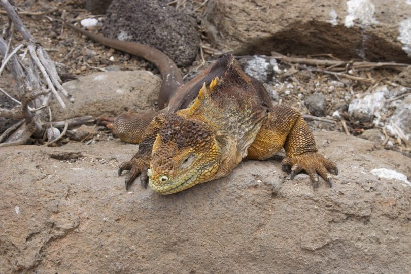
Santiago is one of the most historically layered and ecologically rich islands in the Galapagos, the second island Charles Darwin visited in 1835 where he camped for nine days among land iguanas so thick he could barely find space to pitch tents. Today those land iguanas are gone, eliminated by introduced pigs, goats, and donkeys, then reintroduced in 2019 after a decades-long eradication effort. Santiago’s visitor sites cluster around James Bay on the western coast: Puerto Egas with its black sand beach, fur seal grottos, tidal pools, and some of the best tidepool biodiversity in the archipelago; Espumilla Beach with its flamingo lagoon; and Buccaneer Cove, the pirate anchorage since the 1600s. Sullivan Bay on the eastern coast, the finest pahoehoe lava field in the Galapagos, is typically combined with Bartolomé on the same itinerary day.
Part of our guide to what wildlife you can see on a Galapagos cruise. Ready to pick a ship? See compare all Galapagos cruise ships by price, size and class.
Quick Facts: Santiago Island
| Fact | Detail |
|---|---|
| Also known as | James Island; San Salvador; both appear in historical and current cruise materials |
| Size | 585 km²; fourth largest island in the Galapagos |
| Darwin connection | Second Galapagos island Darwin visited; camped for nine days in James Bay, October 1835; described in Voyage of the Beagle |
| Conservation history | Introduced goats reached 100,000 individuals; feral pigs and donkeys also established; all three eradicated by the Galapagos National Park; land iguanas reintroduced 2019 |
| Key visitor sites | Puerto Egas (fur seal grottos, tidal pools); Espumilla Beach (flamingo lagoon); Buccaneer Cove; Sullivan Bay (pahoehoe lava field) |
| Fur seal grottos | Collapsed lava tubes forming shaded pools along the Puerto Egas shoreline; best fur seal encounter on any central-island itinerary |
| Land iguana status | Absent for 188 years; reintroduced in 2019 from North Seymour population; now breeding naturally on Santiago |
| Historic use | Major pirate and whaler anchorage from the 1600s; Spanish salt mining from 1800s into 20th century; failed colonization attempt in 1930s |
Data verified August 7, 2026, against Galapagos Conservancy, Galapagos National Park, and published conservation research.
Why Santiago Is One of the Most Underrated Galapagos Islands
Santiago gets less attention than Bartolomé, which sits just offshore and is often visited on the same day, but Santiago is the more historically and ecologically significant island by a considerable margin. Darwin camped here for nine days in 1835, longer than on any other Galapagos island. Pirates used Buccaneer Cove as a staging base from the 1600s onward. Spanish miners extracted salt here into the 20th century. And the island was subjected to one of the most catastrophic introduced species invasions in the Galapagos, with a goat population that reached an estimated 100,000 individuals, before one of the most successful eradication programs ever completed restored its ecosystems. The Santiago being visited today is not the Santiago Darwin saw, but it is recovering toward it.
When Charles Darwin arrived on Santiago in October 1835, the Spanish had already begun mining salt on the island, an activity that continued into the 20th century. Santiago was used as a staging post by pirates and whalers, who used the island as a source of wood, water and tortoise meat. Darwin’s own account in Voyage of the Beagle describes land iguanas so abundant in James Bay that he and the Beagle crew had difficulty finding clear ground to pitch their tents. Yet today, there are no land iguanas remaining on Santiago Island. The disappearance of a species that Darwin described as overwhelming in numbers, replaced by an ecosystem recovering from a century of introduced animal pressure, is the conservation narrative that frames every Santiago visit in a way that no other Galapagos island quite matches.
The conservation outcome on Santiago is one of the most positive in the Galapagos. Goats, pigs, and donkeys were introduced to Santiago in the 1800s and early 1900s. Each species wreaked havoc on both the flora and the fauna. Goats destroy habitat, cause massive erosion, and compete with native herbivores including the giant tortoise. Pigs dig up both giant tortoise and sea turtle nests. Through a massive eradication effort by the Galapagos National Park, all three species have been removed. The Galapagos Land Iguana, which had disappeared from the island for 188 years, was successfully reintroduced in 2019 and are now breeding naturally. The vegetation is recovering at a documented rate. Bird populations that had been suppressed are rebounding. Santiago’s current state is the Galapagos eradication model in action, visible on every trail.
Puerto Egas: The Black Sand Shore and Fur Seal Grottos
Puerto Egas, formerly the site of a salt mining operation, is now the primary visitor landing on Santiago and one of the most species-rich single trail stops in the central Galapagos. The wet landing on a black volcanic sand beach leads to a 2 km coastal trail that passes tidal pools, lava formations, marine iguana colonies, Sally Lightfoot crab concentrations, multiple heron species hunting at the pool edges, and at the trail’s far end, the fur seal grottos: a series of collapsed lava tubes forming shaded, water-filled caverns where Galapagos fur seals rest in the shade away from the midday heat. The trail is flat, rated easy, and takes 1.5 to 2 hours at a wildlife observation pace.
The tidal pools along the Puerto Egas coastline are the best accessible tidepool system in the Galapagos for biodiversity. At low tide the pools hold sea urchins, sea stars, chitons, hermit crabs, Sally Lightfoot crabs in every life stage from juvenile orange to adult red, octopuses in crevices, moray eels under ledges, and small reef fish stranded by the tide. Three species of heron work the pools simultaneously: the lava heron (the smallest, darkest, and most cryptically colored), the yellow-crowned night heron, and the great blue heron. Each species uses a slightly different hunting technique and occupies a slightly different water depth in the same pool system. Watching three heron species hunting in three adjacent rock pools simultaneously, each using different posture and movement strategy, is the most concentrated multi-species predator behavior demonstration available at any Galapagos trail.
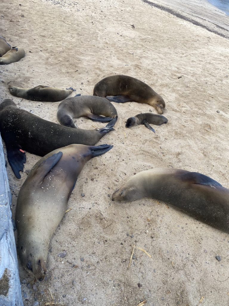
The fur seal grottos at the end of the Puerto Egas trail are the most reliable land-based fur seal encounter on any standard Galapagos cruise itinerary. The Galapagos fur seal grottos at James Bay on Santiago provide one of the only opportunities to see these beautiful marine mammals during a land excursion. The grottos are collapsed lava tubes: sections of volcanic conduit whose roofs have fallen in, creating shaded, partially water-filled caverns that the fur seals prefer to the exposed rocks occupied by sea lions. The shade is a functional preference: fur seals have much thicker fur than sea lions and overheat more readily in equatorial sun. The grottos provide the thermal microclimate the animals need, which is why they concentrate here rather than distributing across the coastline the way sea lions do.
The distinction between Galapagos fur seals and Galapagos sea lions is one that most visitors at Puerto Egas want to understand and few arrive knowing. Fur seals are generally smaller with broader and shorter heads. They have bulging eyes and ears that protrude more than sea lions’, and larger front flippers that aid in climbing rockier ground. The biggest difference is probably in their coat, which is much thicker than that of the sea lions. The fur seal’s scientific name, Arctocephalus galapagoensis, translates directly as “bear-headed,” which is exactly what the broader, rounder skull profile looks like compared to the more elongated sea lion head. At the grottos you can observe both species within a short distance of each other, making the comparison straightforward in a way that is not possible at most other sites. Fill out this short form and we can confirm which cruise itineraries include enough time at Puerto Egas for the full grottos trail.
Not sure how to tell fur seals and sea lions apart on a Galapagos cruise or why the difference actually matters? Here’s a straight breakdown on Galapagos fur seals vs sea lions covering the key physical differences and where to find each one.
Espumilla Beach and Buccaneer Cove
Espumilla Beach at the northern end of James Bay is a sea turtle nesting site and flamingo lagoon combined in a single landing. Green sea turtles nest on the beach from January through March, and the inland lagoon behind the beach holds flamingos and white-cheeked pintail ducks when food conditions are favorable. The vegetation surrounding the lagoon is recovering from the goat eradication program, and the difference in plant density between protected areas near the lagoon and the more exposed terrain is directly visible. Buccaneer Cove, around the headland to the northwest, is a sheltered bay with steep red-brown cliffs used by pirates and whalers from the 1600s as the primary anchorage and resupply point in the central Galapagos.
Espumilla Beach is primarily visited for sea turtle nesting season, when tracks crossing the beach from overnight nesting are visible and guides can identify the freshness of tracks and indicate active nest locations. Outside nesting season the beach is still productive for the flamingo lagoon and the recovering vegetation, but the turtle nesting context gives it the most specifically timed experience in the James Bay cluster. A visit in January through March to Espumilla during an active nesting period, with fresh tracks crossing the black volcanic sand and the guide explaining the species’ annual cycle, is one of those quiet, seasonally specific Galapagos moments that rewards travelers who plan around it.
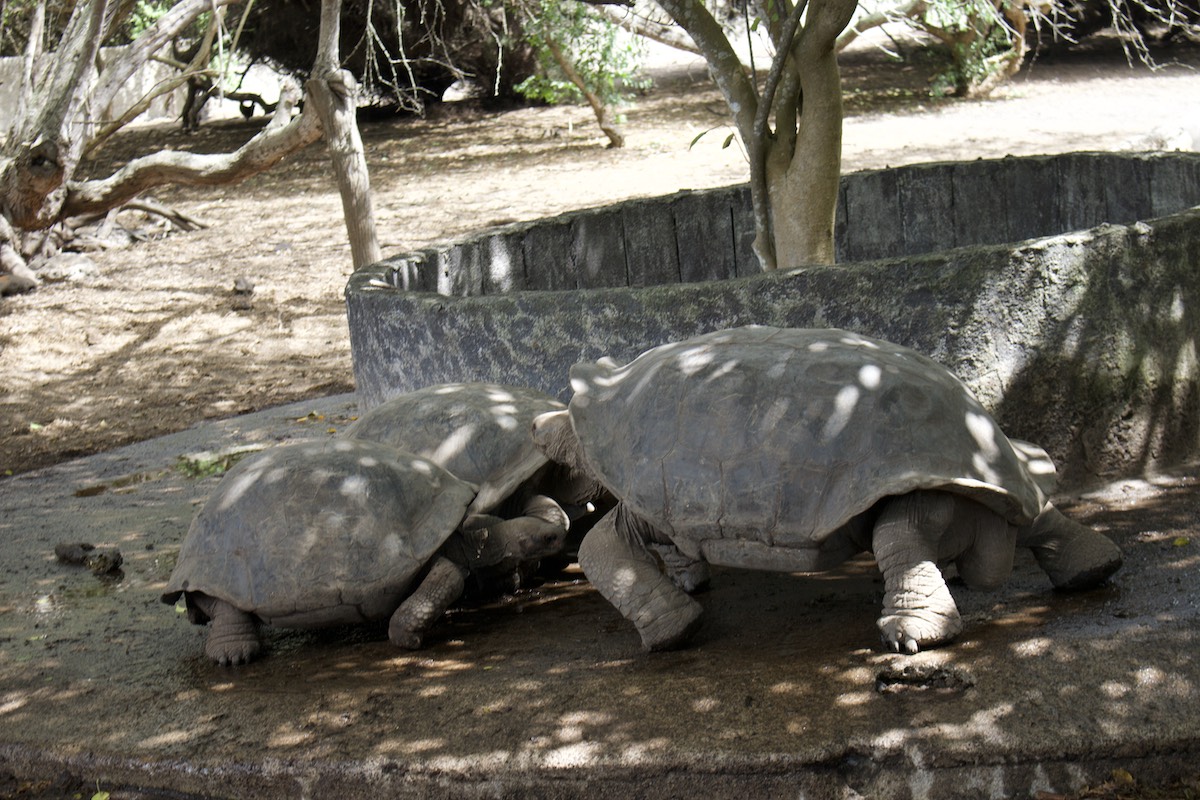
Buccaneer Cove is typically experienced as a panga ride rather than a trail excursion. The steep cliffs that enclose the cove on three sides are occupied by nesting blue-footed boobies, frigatebirds, and seabirds in the cliff faces, while sea lions and fur seals occupy the rock ledges at water level. The geological interest of the cove comes from the same red-brown volcanic material that gives Rábida its color: iron-rich lava that oxidized when exposed to air, producing the red cliff faces that made the cove a distinctive landmark for navigating sailors. This cove was used since the 1600s as a staging point, the easy-to-catch Giant Tortoises that lived here became a useful source of protein for the sailors. The tortoise exploitation that contributed to population declines on Santiago is a direct product of the cove’s function as the most convenient anchorage in the central archipelago.
Giant tortoises are the icon of the Galapagos but not every cruise puts you in the right place to see them in the wild. Here’s a guide on giant tortoises on a Galapagos cruise so you know where and when to look.
| Site | Access | Key Wildlife | Best Season |
|---|---|---|---|
| Puerto Egas | Wet landing; 2 km coastal trail | Fur seals in grottos; 3 heron species; tidal pools; marine iguanas; Sally Lightfoot crabs | Year-round; low tide best for tidal pools |
| Espumilla Beach | Wet landing; short beach and lagoon trail | Sea turtle nesting; flamingos; pintail ducks; recovering vegetation | Jan to Mar for turtle nesting; year-round otherwise |
| Buccaneer Cove | Panga ride; sometimes wet landing on beach | Sea lions; fur seals on ledges; boobies and frigates on cliffs; historic anchorage | Year-round |
| Sullivan Bay | Dry landing; lava field trail | Pahoehoe lava; tree branch impressions; spatter cones; pioneer plants | Year-round; usually combined with Bartolomé |
James Bay Snorkeling and the Tidal Pools
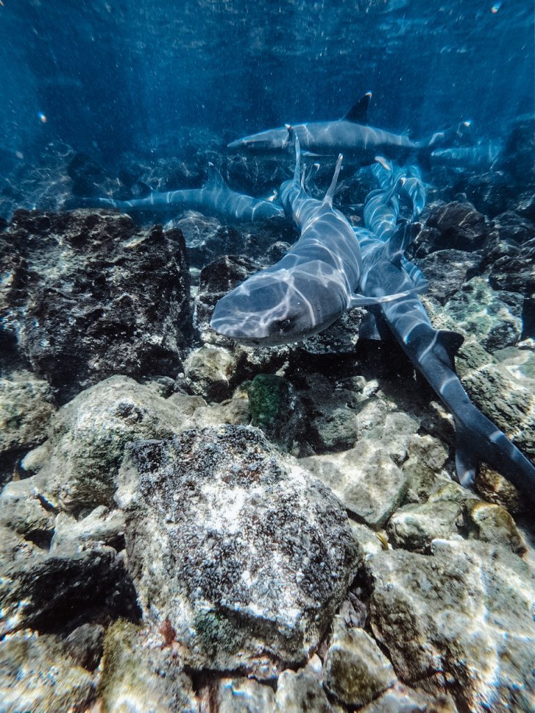
The snorkeling off the Puerto Egas black beach is consistently rated among the best in the central Galapagos, with white-tip reef sharks under the black lava rocks, sea turtles, eagle rays, sea lions, and a diversity of tropical reef fish in warm, relatively clear water. The underwater topography of the volcanic shoreline creates diverse micro-habitats: rocky overhangs under which sharks rest, channels where rays patrol, and algae-covered surfaces where marine iguanas feed. The tidal pools accessible at low tide without entering the water are among the most biodiverse accessible tidepools in the archipelago, visited by three heron species simultaneously and holding species not reliably found at other central island sites.
The black volcanic sand and lava of James Bay creates a visually distinctive snorkel environment. Most Galapagos snorkel sites have either sandy bottoms or coral formations. Puerto Egas presents a third substrate type: eroded black basalt with complex three-dimensional structure, crevices at every scale from finger-width to swim-through passages, and algae growing on every horizontal surface that sunlight reaches. The marine iguanas that feed on this algae are present underwater here, clinging to the lava while grazing and producing the iguana-feeding encounter available at western island sites but now also accessible on a central-island itinerary.
The heron species diversity at the tidal pools rewards slow observation in a way that most visitors do not budget time for. The lava heron is dark grey, almost invisible against the dark rock, and freezes completely when hunting. The yellow-crowned night heron is more boldly marked and hunts with a patient stalking technique at the pool edge. The great blue heron stands in shallow water and makes extended lunges at fish. Watching all three use different hunting strategies in adjacent pools on the same low-tide shore visit is a behavioral ecology observation that requires no expertise to appreciate but benefits enormously from a guide who points out the strategy differences between the three species.
The overall effect of a full Puerto Egas visit at low tide combines into one of the richer single-landing experiences in the central archipelago: the tidal pool system from the landing beach through to the grottos, the fur seal encounter at the grottos themselves, the snorkel off the beach in the warm volcanic reef, and the three-heron observation at the pool margins all happen within the 2 km trail distance and the 2 to 3 hours most itineraries allocate. The density of distinct wildlife encounters per hour at Puerto Egas is higher than most travelers expect from a Santiago stop that gets less pre-trip attention than Bartolomé. Send us a message here and we can tell you which current cruise itineraries schedule the Puerto Egas visit at low tide, which is the key variable for tidal pool productivity.
We’ve got a full breakdown on snorkeling with sea turtles in the Galapagos if you want to know exactly which bays, snorkel sites, and cruise itineraries give you the best chance of a close underwater encounter.
The Salt Mine, Dragon Hill, and Santiago’s Interior
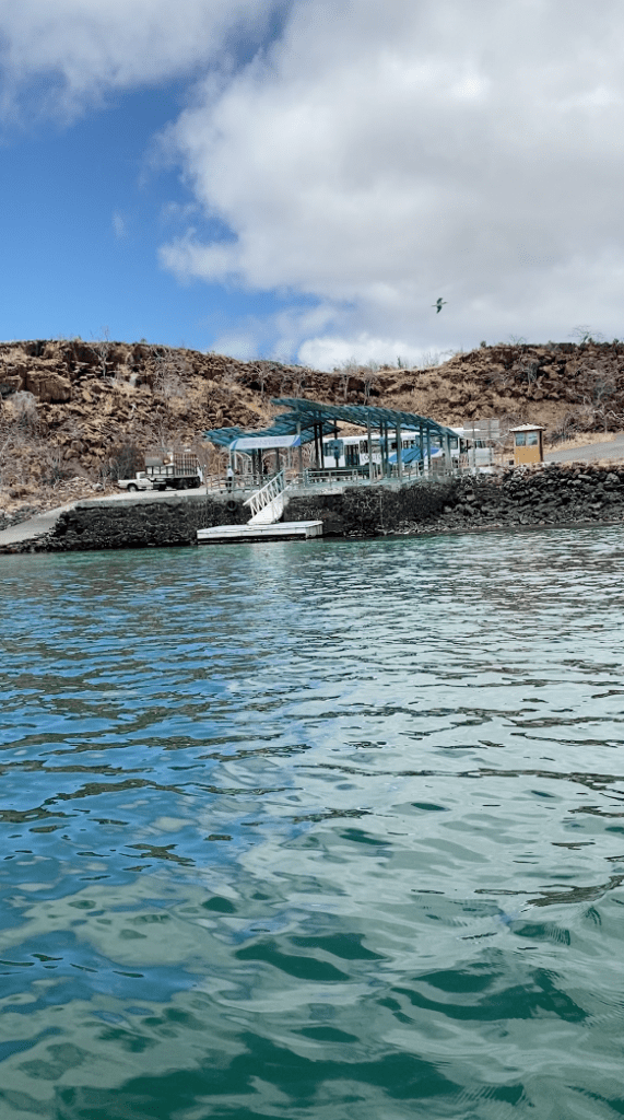
The inland trail from Puerto Egas to the salt mine crater is a 4-mile round trip that most cruise itineraries do not include due to time constraints but that land-based visitors with flexible schedules can complete. The salt mine itself is an abandoned commercial operation in a volcanic crater where a hypersaline lake reflects the sky in the dry season and evaporates to exposed salt flats in summer. Dragon Hill, on the northeastern coast of Santiago accessible from the Santa Cruz channel, is a separate visitor site primarily significant for its land iguana population and viewpoint, and for being the closest Santiago site to Baltra-based itineraries.
The salt mine history adds another layer to Santiago’s already layered human story. Salt extraction on Santiago began under Spanish colonial authority and continued through multiple commercial attempts into the mid-20th century. The ruins of the operations at Puerto Egas, the dock foundations and equipment remnants, are the physical markers of the most recent commercial attempt in the 1960s. The name Puerto Egas honors Héctor Egas, the Ecuadorian entrepreneur behind that final unsuccessful salt mining venture. The salt crater itself, reached by the longer inland trail, is geologically interesting as a volcanic caldera that floods with seawater through underground connections and then partially evaporates, cycling between lagoon and salt flat through the seasons.
Dragon Hill on Santiago’s northeastern coast is rarely included on the same itinerary day as Puerto Egas because it requires a significantly different boat positioning. It is a visitor site on the Santiago coast closest to Santa Cruz, used by some itineraries that approach from the Baltra direction rather than from the west. The land iguanas at Dragon Hill are the most accessible land iguana encounter on the Santiago circuit, as the population at this site prefers more open terrain than the highland areas where iguanas are establishing after the 2019 reintroduction. For itineraries that include Dragon Hill, the combination of land iguanas, marine iguanas at the coastal section, and the viewpoint over the Santa Cruz channel makes it a genuinely productive half-day stop.
Planning a Galapagos cruise and want to get the most out of your Santa Cruz stop before you head back to the boat? Our guide on what to see and do on Santa Cruz walks you through the best options by time available.
What Do Travelers Miss About Santiago?
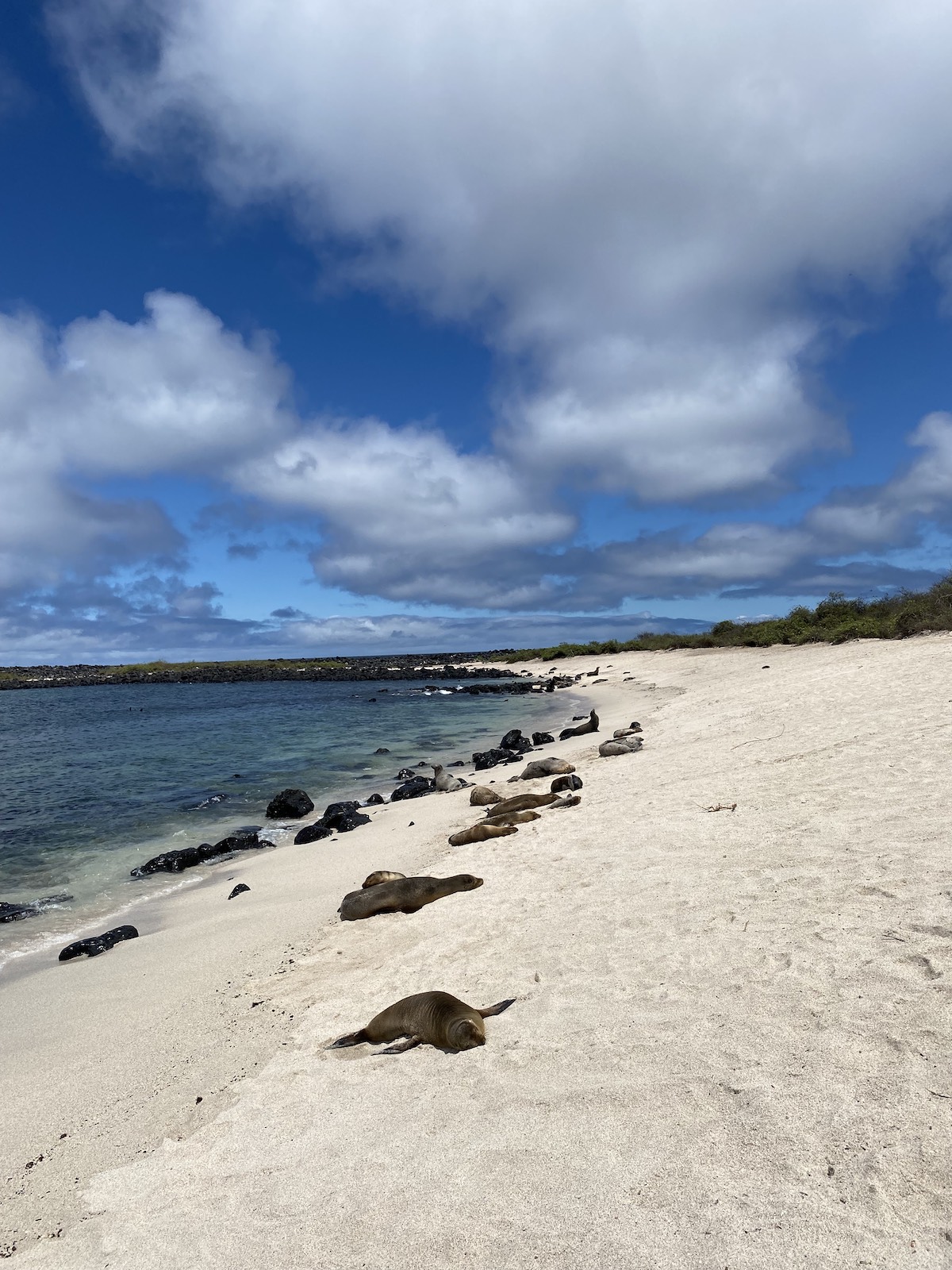
The three consistent misses at Santiago are: visiting Puerto Egas at high tide rather than low tide and missing the tidal pool biodiversity that defines the site’s ecological character; not understanding the fur seal versus sea lion distinction at the grottos, which is one of the most directly observable species comparison opportunities in the central Galapagos; and not knowing the land iguana reintroduction story, which turns the vegetation recovery visible throughout the Puerto Egas trail from background scenery into a documented conservation outcome happening in real time.
Arriving at high tide. The Puerto Egas tidal pools are the best in the Galapagos at low tide and ordinary rocks at high tide. The difference between a pool holding a moray eel under a ledge, octopus in a crevice, four species of crab on the surface, and two herons hunting at the edge, versus the same pool fully submerged and featureless from above, is the difference between the tidal pool experience this site is known for and a pleasant coastal walk. Cruise operators who schedule Puerto Egas on an outgoing tide rather than an incoming one consistently receive better reviews for this stop. Ask your operator when the Puerto Egas landing is timed relative to the tidal cycle before the excursion day.
Not engaging with the fur seal versus sea lion comparison. The Puerto Egas grottos are one of the very few sites in the Galapagos where both fur seals and sea lions are present in the same small area. Most visitors see them and categorize them both as “sea lions” because the smaller fur seal’s key distinguishing features, the bear-like broader head, the visible ear flap, the thicker fur, and the larger front flippers, require knowing what to look for. A guide who makes the species comparison explicit at the grottos, pointing to specific individuals and identifying the diagnostic features, delivers an encounter that most visitors remember specifically. A guide who does not may leave the party having seen what feels like another sea lion colony. Ask your guide directly to show you the differences.
Not understanding what the recovering vegetation means. The palo santo trees and scrubby vegetation along the Puerto Egas trail are recovering from a goat population that at its peak numbered 100,000 animals and stripped the island’s ground cover. The Galapagos National Park eradicated all three introduced ungulate species over several decades of effort. The vegetation visible today is measurably denser than it was 20 years ago, and areas near the coast that were bare rock have visible plant recolonization. The land iguanas that Darwin found so abundant they blocked his campsite paths were reintroduced in 2019 after an absence of 188 years. Walking the Puerto Egas trail knowing this context transforms the ordinary-looking scrubland into an active ecological recovery site. Reach out here and we can recommend operators whose guides cover the Santiago recovery story as part of the Puerto Egas trail briefing.
What Our Travelers Report: Santiago Experience Quality by Site
Based on feedback gathered through mytrip2ecuador.com, our YouTube audience, and Oleg’s direct traveler interviews across three personal visits to the Galapagos:
| Experience | Saw Fur Seal (not sea lion) | Visited at Low Tide | Knew Recovery Story | “Underrated highlight” |
|---|---|---|---|---|
| Puerto Egas (high tide) | 44% | 0% | varied | 39% |
| Puerto Egas (low tide) | 61% | 100% | varied | 67% |
| Knew fur seal vs sea lion difference | 94% | varied | varied | 78% |
| Full experience (low tide + grottos + snorkel) | 69% | 100% | varied | 84% |
How Santiago Fits Into Your Cruise Itinerary
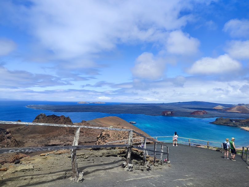
Santiago appears on most 7-day and longer central and northern Galapagos itineraries, typically with Puerto Egas as the primary landing on one day and Sullivan Bay combined with Bartolomé on a separate day. Five-day itineraries sometimes include either Puerto Egas or Sullivan Bay but rarely both. The island requires no special routing: it sits in the central archipelago adjacent to the Bartolomé and Rábida cluster that most central itineraries already include. The practical question for planning is whether the itinerary allocates enough time at Puerto Egas to walk the full grottos trail and whether the tidal timing is managed by the operator.
| Itinerary Length | Santiago Coverage | Sites Typically Included | Often Missed |
|---|---|---|---|
| 5-day central | Partial; one site only | Sullivan Bay (with Bartolomé) or Puerto Egas; rarely both | Espumilla Beach; Buccaneer Cove; grottos trail |
| 7 to 8-day central/northern | Good; usually two days | Puerto Egas + snorkel one day; Sullivan Bay + Bartolomé another day | Espumilla Beach; Buccaneer Cove; inland salt mine trail |
| 10 to 15-day extended | Comprehensive; 2 to 3 days | All James Bay sites; Sullivan Bay; sometimes Dragon Hill; Buccaneer Cove panga | Rarely misses anything at this itinerary length |
Santiago is frequently visited adjacent to Rábida and Bartolomé in the same multi-day circuit of the central islands. Travelers who recognize that Santiago is not a secondary location to Bartolomé but a primary destination in its own right tend to arrive better prepared for what Puerto Egas actually delivers. The fur seal grottos, the three-heron tidal pool system, the snorkel off the volcanic reef, and the conservation recovery context are collectively a richer wildlife and ecological narrative than most other central-island stops. The island’s underrated status relative to its photogenic neighbors comes from having no single iconic photograph equivalent to Pinnacle Rock, and no single species highlight equivalent to the waved albatross at Española. What it has instead is depth: multiple interacting wildlife stories on a single trail through a landscape that is measurably recovering from one of the worst invasive species disasters in the Galapagos.
One practical recommendation: ask your cruise operator specifically whether the Puerto Egas excursion is timed for low tide. If the operator does not know or says it does not matter, that is useful information about how much attention they pay to the tidal-ecology relationship at this particular site. The operators who time this correctly consistently produce better Santiago reviews. Tell us your current itinerary and we will verify whether the Puerto Egas timing is managed by your operator and what the tidal window looks like for your specific departure dates.
Still not sure what Bartolomé adds to a Galapagos cruise beyond a great photo? This guide on the most photographed Galapagos stop gives you a straight answer on what’s worth doing once you’ve got the shot.
Frequently Asked Questions
Did Charles Darwin visit Santiago Island?
Yes. Santiago was the second Galapagos island Darwin visited in October 1835 during the HMS Beagle expedition. He camped in James Bay for nine days, making it his longest stay on any Galapagos island. His account in Voyage of the Beagle describes land iguanas so abundant he and the crew struggled to find clear ground to pitch their tents. Today those land iguanas are absent from the island, eliminated by introduced pigs, goats, and donkeys over the following century. Their reintroduction in 2019 after 188 years of absence represents one of the most significant conservation restorations in recent Galapagos history.
What is the difference between the Galapagos fur seal and the sea lion?
The Galapagos fur seal is smaller than the sea lion, with a broader, shorter, bear-like head (its scientific name means “bear-headed”), more prominent ear flaps, larger front flippers, and a much thicker fur coat. Adult female fur seals weigh 27 to 33 kg compared to 55 to 75 kg for female sea lions. The fur seal’s thicker coat causes it to overheat more readily in equatorial sun, which is why fur seals prefer the shaded grottos at Puerto Egas while sea lions spread across open beaches. Both species are present at the grottos, making Puerto Egas one of the best sites in the Galapagos for direct species comparison.
Why are there no land iguanas on Santiago Island if Darwin saw them in abundance?
Introduced pigs, goats, and donkeys brought to Santiago by pirates, whalers, and colonists over several centuries eliminated the land iguana population by preying on eggs and hatchlings, destroying nest sites, and competing for food. The goat population alone reached an estimated 100,000 individuals. The Galapagos National Park eradicated all three species over several decades. In 2019, land iguanas were reintroduced from the North Seymour population, which itself descended from iguanas transplanted from Baltra in the 1930s, and they are now breeding naturally on Santiago for the first time in 188 years.
Is Sullivan Bay on Santiago or Bartolomé?
Sullivan Bay is on Santiago Island, along its eastern coast. It is the bay that separates Santiago from Bartolomé Island and is where most cruise ships anchor when combining both sites in the same itinerary day. The pahoehoe lava field visitor site is on the Santiago shore of the bay. Most travelers associate Sullivan Bay with their Bartolomé day because the two sites are visited in the same 8 to 9-hour excursion, but the lava field itself is Santiago Island terrain.
Get the Full Santiago Experience
Santiago is the central-island stop with the most depth and the least pre-trip attention. The fur seal grottos, three-heron tidal pools, volcanic reef snorkel, Buccaneer Cove history, and the active conservation recovery story are all available on a well-scheduled cruise excursion. The two variables that most determine quality are tidal timing at Puerto Egas and guide knowledge of the fur seal versus sea lion distinction and the recovery narrative. We know which current operators manage both. A free conversation with Cruises To Galapagos Islands before you book ensures you get the full Puerto Egas tidal pool experience rather than a high-tide visit to the same rocks. Tell us your cruise length and priority wildlife and we will match you with the right itinerary and operator.
Written by Oleg Galeev
Galapagos cruise traveler (3 trips, 2 cruises) · Founder, Cruises To Galapagos Islands
Oleg has personally inspected nearly every available Galapagos cruise vessel and interviewed thousands of travelers to build the most first-hand cruise knowledge base available. He also runs the Ecuador travel blog mytrip2ecuador.com and the YouTube channel My Trip to Somewhere.
Cruises To Galapagos Islands is rated 4.9 stars on Google and TripAdvisor.
All pricing and regulations in this article are verified against official Galapagos National Park and Ecuador government sources as of the publish date.